Monday, October 6, 2014

Cloudsplitter 100 - 62 miles of steep

"This is just crazy", said the waitress at the Hilton Garden Inn in Pikeville, KY when I explained the basics of the Cloudsplitter 100, in response to her inquiring about my race outfit.  It was early on Saturday morning and I was the first person to show up for breakfast. She kept going but her thick southern twang sounded to me like a foreign language. My Austrian accent was likely incomprehensible to her as well, so I didn't tell her that I had just spent the week in London before flying back to Dayton and driving for five hours on Friday evening to reach this remote part of the country. But I was sure it would have solidified her opinion.

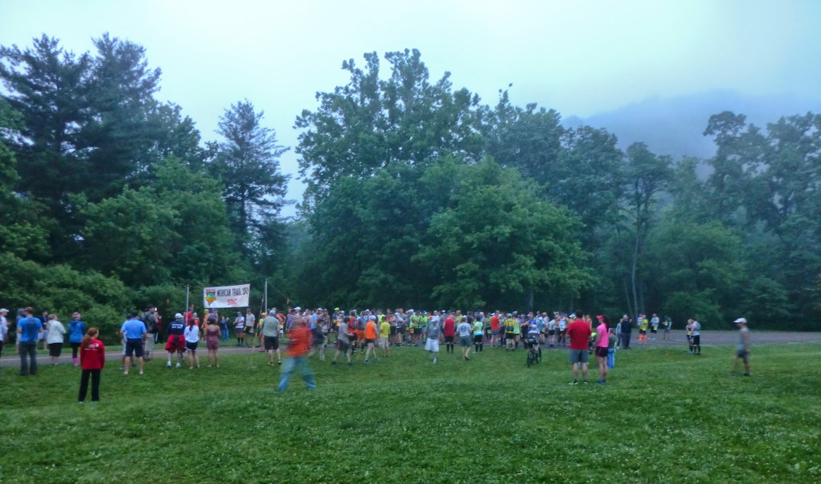
The Cloudsplitter 100 was the first ultra marathon mountain race ever held in the state of Kentucky. It was located on Pine Mountain in the heart of Appalachia. Several distances were offered including 100 miles and 100 kilometers.  I had signed up for the shorter of these two options, thinking it would be crazy to attempt 100 miles.  Obviously that distinction made little difference to the waitress.  She clearly thought I was crazy anyway. And since this was my first-ever 100 kilometer race, considered to be one of the hardest trail races in the Eastern United States, I did not feel inclined to protest.


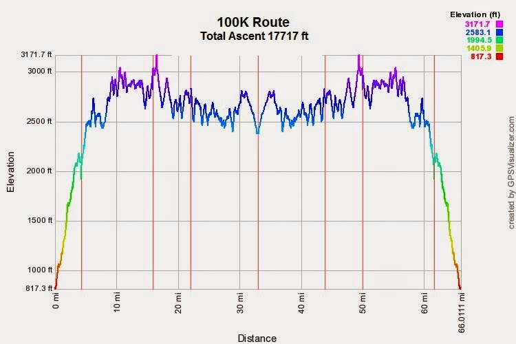
Elevation profile of the 100 kilometer route

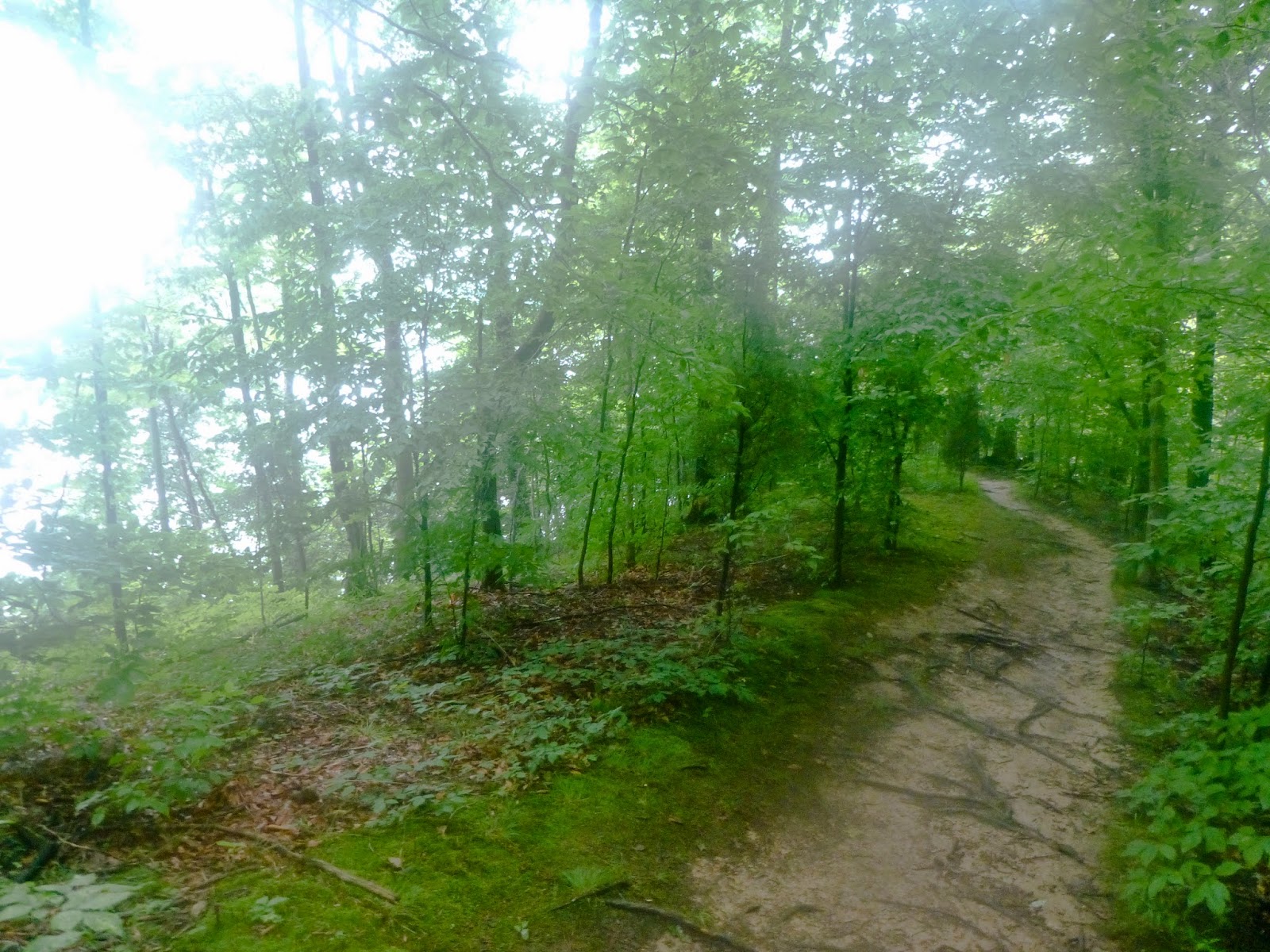
The Pine Mountain Scenic Trail started at the bottom of the valley in Elkhorn City (population 964), ascended steeply to the top of the ridge, and then traced a geological fault line along the southern Kentucky-Virginia border. Virtually no section of the trail was flat. It either went up or down, and more often then not, the grades were very steep. This explains why, over a distance of 100 kilometers, the trail climbed 17,000 feet - more than the total elevation of Mont Blanc from sea level. 


Climb from Elkhorn City

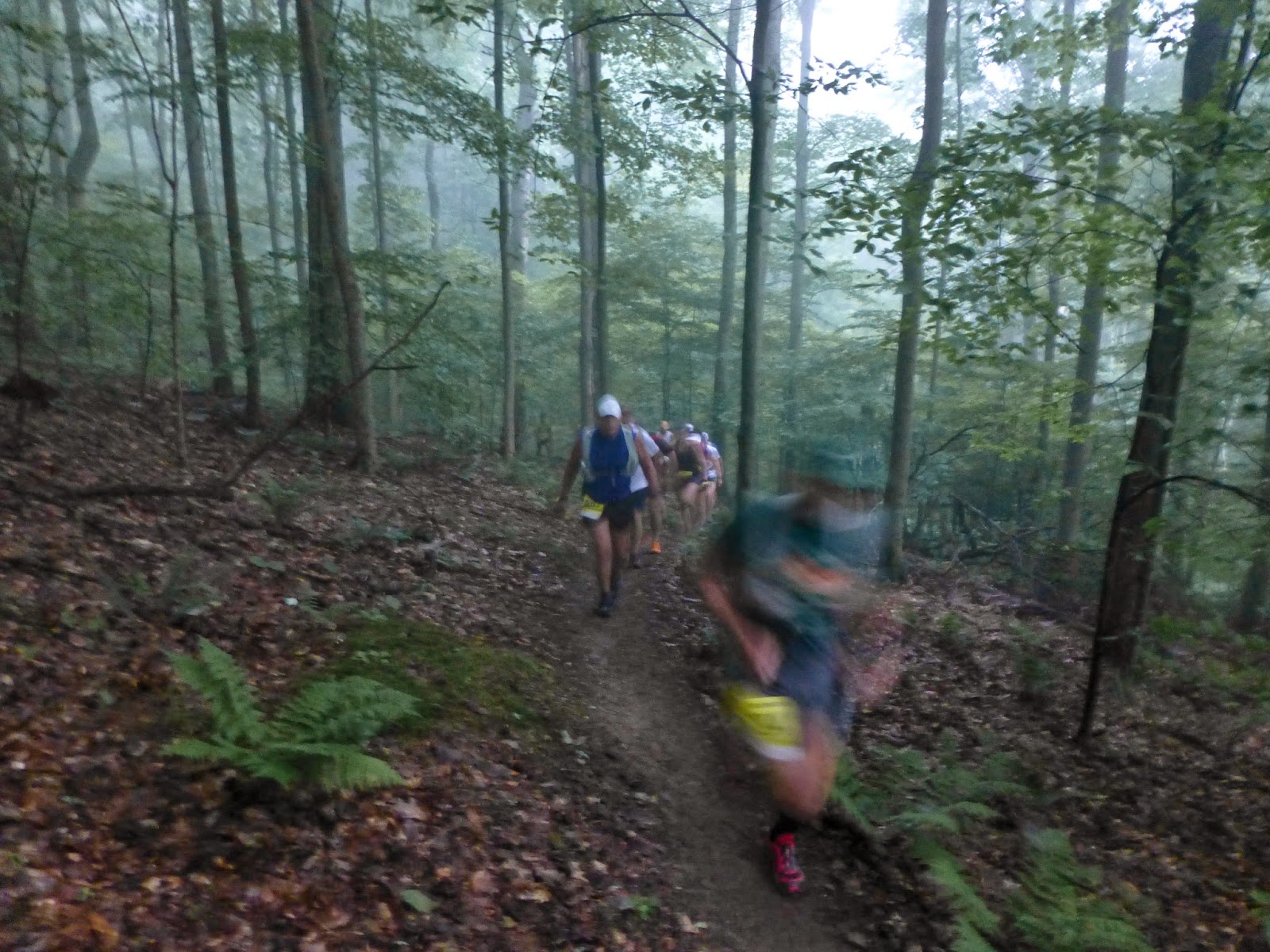
Although my legs were fresh, I decided to take it easy and positioned myself towards the back of the pack. Everyone around me was walking the initial climb from Elkhorn to the first aid station 12 km into the race. Although it was quite cool (6 degrees C), climbing generated a lot of body heat, and I stopped to remove my long sleeves.  


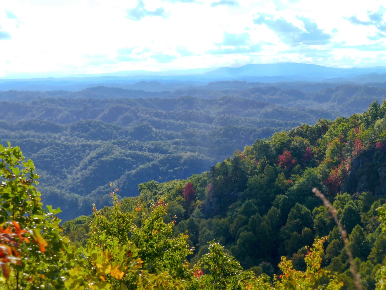
Views of the Appalachian Mountains of Virginia to the south

As we approached the ridge, the woods opened up to reveal breathtaking views of Virginia.  This was a welcome excuse for a short break to take some pictures. The leaves just started to take on color. The air was crisp and clear. Only a day or two ago it had still been very warm, but now Fall had definitely arrived.


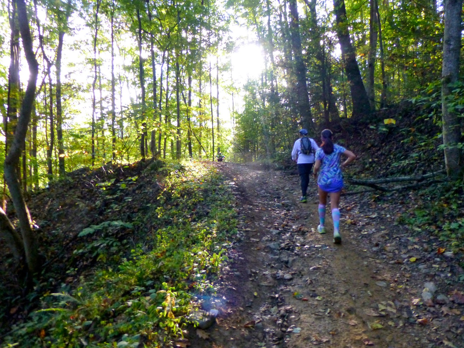
Rhododendron thickets made route finding challenging - even during the day

A few runners got lost in the midst of giant rhododendron bushes, and vigorously argued which trail was correct. According to the US Forest Service, Rosebay rhododendron is native to Southern Appalachia and can grow 40 feet tall with trunks up to 12 inches in diameter. It forms dense thickets that exclude almost all sunlight from the forest floor, with its maze of twisted, tangled stems. Local mountaineers have labeled these all but impenetrable snarls of vegetation "hells" or "slicks." It was definitely confusing and left me wondering about the challenges I would face on the return trip, when it would be completely dark.


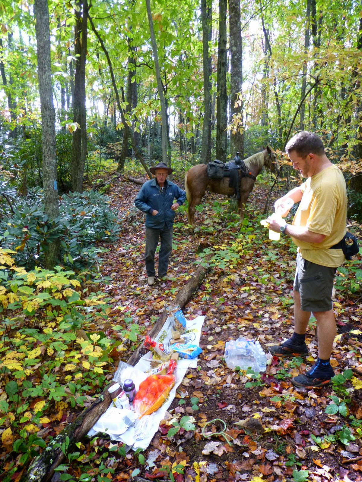
Aid station #2 - supplied by pack horse

The second aid station was in such a remote part of the forest that it could only be reached by pack horse. I reminded myself to be extra careful with my footing. I did not like the idea of having to be rescued on horseback in case of an injury.

The aid station volunteer explained that the local horse club was responsible for maintaining the trail. They obviously had done a great job and I asked him to pass on my thanks to his fellow club members.


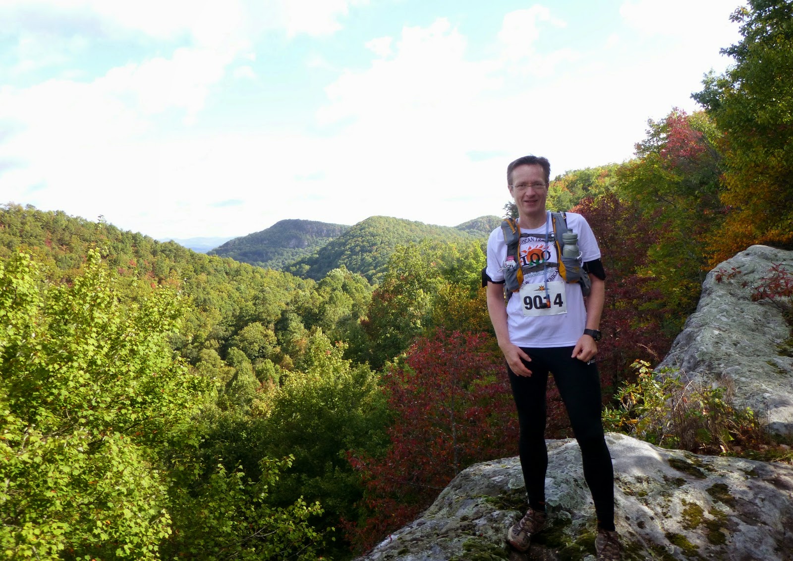
Still looking fresh - along the ridge in the morning

The next section offered exceptional scenery as the trail traced narrow ledges formed by granite blocks. The views were exceptional in all directions, even if there was the occasional sign of human intervention in the otherwise pristine wilderness.


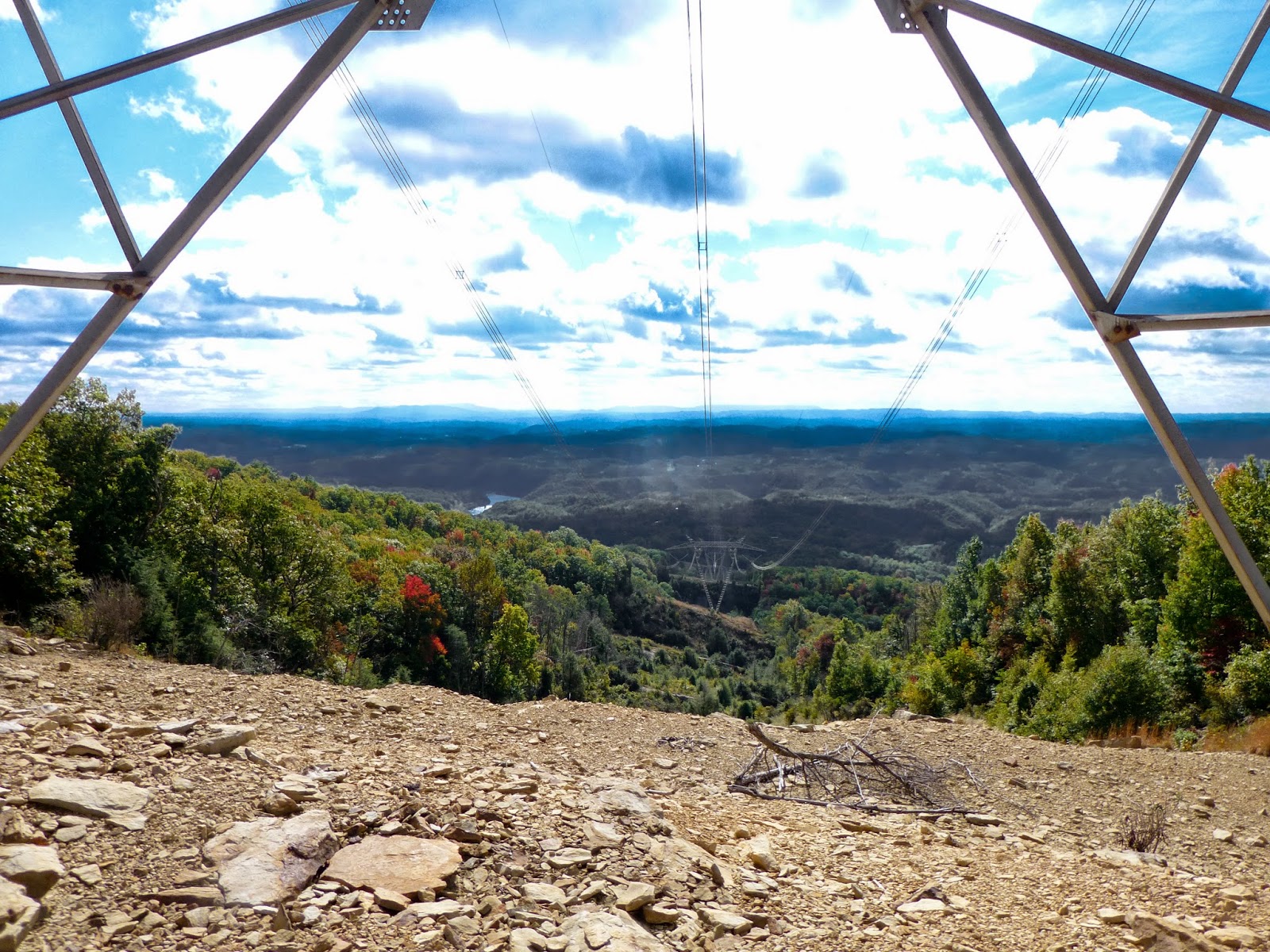
Power line running across the ridge

It seemed one could feel the electricity when crossing underneath this power line at the top of the ridge. This was especially palpable later on the dark return leg.


Steep trail

It was impossible to truly capture how steep many of the sections were.  GPS indicated grades of up to 40%. Descending such inclines often took me longer than climbing them.


Signs telling stories of pioneers ... and murder.

Several signs told a little bit of Appalachian history.  I was hoping that times had changed ...


Representative view of the second half of the race

About an hour and a half before sunset I reached the half-way point of the race.  The last few miles had been long and tedious and I was glad to reach the aid station.  After eating three cups of potato soup, changing my socks and shoes, and donning my lights, I felt rejuvenated and ready to take on the second leg of the race that would lead me right into the night.

A ranger told me about the frequent bear encounters and insisted that I be careful. Several racers had already spotted bears out on the course. I continued with some trepidation as it gradually got darker and darker. However, once the light was completely gone, I got used to moving through the night. The trail was quite technical and demanded a lot of attention in order to avoid tripping over rocks and roots. That, in addition to focusing on navigation, made me soon forget about the bears.

Just after it had turned completely dark, I caught up to another racer. Tackling the night together felt a bit easier as we continued onwards. Unfortunately, he soon developed severe stomach issues and had to stop at the next aid station, where two medical students promised to take care of him. We were in a very remote location.  It had taken the students more than two hours to reach the trail per ATV on a very rough and steep track. Driving an ATV at night was impossible, so they offered to keep the racer in one of the tents they had set up for themselves.

It was just past 9 PM, and with the nearest racer 30 minutes ahead of me, I had no choice but to continue on my own. Running was now pretty much out of the question, and with about 35 kilometers left to go, it promised to be a long and lonely walk. I kept in good spirits and trudged along.  I considered listening to music or an audio book but decided against it, so I could stay better aware of any animal activity. 

The temperature was dropping precipitously and the forecast was for frost above 3,000 feet, which was where I headed.  The wind picked up as well and the projected chill factor was for negative 5 degrees C.

Suddenly, I heard a loud crack right next to me, my heart rate jumped, and I stopped in my tracks. I turned and spotted the culprit: a deer, caught in my headlight. Just as the saying goes, the deer stood there, frozen, my light shining directly at it, merely a few feet away. It was so close, I could have poked it with a walking stick. At least the adrenaline increased my circulation and I instantly felt a bit warmer.

From then on I must have been on auto-pilot as I don't have many recollections of the following trail sections except that I happily changed into warmer clothing when I picked up my drop bag at the Birch Knob aid station around 11 PM.

Several hours later, at around 2:25 in the morning, I reached the second-to-last aid station, where I was offered to be joined by another runner whose friend had dropped out due to cramps and overwhelming fatigue. I felt sorry for his friend who decided to quit with just 12 kilometers left to go.  Huddled in a hooded sweater next to an open fire pit, he tried to stay warm as he waited for an ATV to pick him up. He looked miserable and did not say a word. 

Nevertheless, I was pleased about the unexpected company as my new-found companion and I headed out together. He was an experienced ultra-runner, and I happily followed in his footsteps, no longer worrying about navigation. We descended a very steep trail into a valley and were making good progress. Spurred on by the company of an accomplished athlete, I picked up the pace and was moving much faster than I had on my own.

Until, suddenly, we came upon a huge tree laying straight across the trail. Neither of us remembered climbing over a tree like this in the morning. Right next to the tree was a pink plastic ribbon like those that were used to mark our course wherever the typical yellow or green blazes were missing. It was puzzling. Had the tree fallen during the race? On closer inspection the color of the ribbon looked somewhat faded. It became apparent that something was not right.  

Before the race I had loaded the gpx track of the route onto my iPhone. Now I was glad that I had skipped the music, which meant that there was still plenty of power left.  The phone delivered proof: we were at least 2 kilometers off track. The good news was that the phone also showed where we needed to go. The bad news was that we had lost at least two hundred meters of altitude, which we had to climb back up to reach the correct trail.  The detour cost us more than an hour.

My companion - who was also an experienced race director - kept complaining about the trail markings, clearly unhappy that this was now becoming his slowest ultra race performance ever. I was in no mood to argue. Instead, I reminded myself that the search for adventure was one of the key reasons why I did this race in the first place. This detour and the subsequent route finding definitely qualified as adventurous.  This thought, and the fact that it was my iPhone that helped us out, allowed me to never lose my good spirits.

After a while I stopped to connect my watch to a back-up charger and suggested to my companion to surge ahead.  I enjoyed doing the remaining kilometers alone, not having to listen to more complaints about the race organization, which I thought had done a remarkably good job putting up this inaugural race in such a remote region and in challenging terrain.

I reached the finish line at 6:30 AM, 22 hours and 28 minutes after setting out the previous morning - proud that I finished my first 100 kilometer run on a very demanding and challenging mountain trail and never considered quitting. I admit there where moments during which I pondered whether the waitress may have been right. But then I decided that I didn't care.

Sunday, June 29, 2014

My hattrick of ultra-running


Sunrise over Caesar Creek Lake

Three weeks after Another Dam 50k, and just one week after my first 50-miler at Mohican, I found myself at sunrise at the starting line of the Dawg Gone Long 50k at Caesar Creek State Park: 3 ultras within one month.

Like me, several other runners showed up in their new Mohican t-shirts. Some of them were running again, others were manning the aid stations.  The community of ultra-running is as small as it is dedicated.
Less than 100 runners were at the start

It was a muggy morning as the sun rose below a layer of clouds over Caesar Creek Lake, painting the sky in shades of purple that soon turned orange.  The temperature was already in the high 70s, the air was still, moist, and heavy.  It seemed a difficult day lay ahead.

Purple skies just before sunrise

The race consisted of 2 loops around the southern portion of Caesar Creek Lake.  I was still not fully recovered from last week’s race and had no specific time goal in mind. I simply wanted to know if I could complete two ultras on two consecutive weekends.

Reflection pond

After the dam crossing, the trail led through the Caesar Creek spillway where 450-500 million year old rocks had been exposed.  These rocks contain a myriad of fossils, mostly clam-like branchiopods, but also bryozoans, corals, and gastropods.  I spotted quite a few fossils but a trail race is not a fossil-hunt, so I did not pick anything up.

Some of the drainages have bridges over the creek beds

After that the trail winds through thick woods, traces the lakeshore in some places, and crosses a few drainages. About 5 miles into the race, the trail led through Caesar Creek Pioneer Village, a collection of historic houses from the 1800s maintained by a non-profit organization dedicated to preserving knowledge about the lives of early settlers in the area.

Water lilies on the East shore of Caesar Creek Lake

At mile 9 the route crossed Caesar Creek Lake on State Route 73 to the Western side, which was much hillier than the Eastern portion.  Throughout the first loop the trail was in fairly good conditions.  There had been a series of Thunderstorms in the past week, but Friday had been dry.  The trail surface was soft and tacky with mud in only a few places where the water had not been able to run off.
 
Ridge along the West shore of the lake

I completed the first loop in 3:45 hours.  I had paced myself well and thought that I might be able to maintain the same pace throughout the second loop.  How wrong that was!

After the rain the trail turned into a gooey mess

A few miles into loop 2 it started to rain.  Only slightly at first, it gradually intensified.  In most places, the soil had already been moist, and was not able to absorb any additional water.  Soon, many portions of trail turned into little creek beds.  Branches of shrubs and trees were heavily leaden with water droplets and sank lower and lower until the trail became a small and narrow tunnel. Up-right running was no longer a possibility and many sections turned into constant ducking and bush-whacking while stomping through a gooey mess as the soil disintegrated.  I was completely drenched but the temperature was now very pleasant in the mid 70s and there was no danger of getting cold.
 
The sun came out towards the end, illuminating the misty forest

As I got back to the Western side the bushwhacking was mostly over as the trees were taller, the trail was wider, and the undergrowth was less dense.  After a little while the rain stopped and even the sun came out in a few spots.  However, the gooey surface remained for the remainder of the race.  The trail was so slippery that I had to walk most of the downhill sections.  Fortunately I wore good trail shoes, which provided more traction than those of a few other runners who I passed during this last leg of the race.  Finally, I reached the finish line (at 53km) after 8 hours and 27 minutes – the slowest time of my three 50ks.  

It was still a lot of fun but I think I’m going to take a break before going out again for another ultra.

Sunday, June 22, 2014

50 Miles of Daylight

At the start line - just before sunrise

June 21.  Summer solstice.  Sunrise in central Ohio is at 5:58AM.  Two minutes later race director Ryan O’Dell sent the runners of the Mohican 50 on their way.  Fog was hanging over the steep slopes of the Clear Fork Gorge, the air was still and moist, and light drizzle emanated from the low hanging clouds.

First hill after the start - ascending in morning mist

I didn’t quite know what to expect.  Exactly 23 months ago, on July 21, 2012, I had run my first-ever foot race in the same place.  It was called Dirty Mo and was about 19 kilometers long.  Yesterday I was back to cover a distance more than four times that.  A distance 70% longer than the longest I had ever moved on foot in one continuous effort.  I had no idea if I would be able to do it, which was also precisely what attracted me to attempt it in the first place: failure was not just possible, it was probable.

Running through a creek bed

I had looked up the finishing times of the slower runners of last year’s event.  The last person who successfully completed the race did so after 19 hours and 10 minutes.  Many others had dropped out.  That meant I had to be prepared to be on the trail until well past midnight.  So I placed a headlight into a drop bag at an aid station that was 60km into the race, hoping to reach it before it got dark. Sunset was going to be at 9:03PM. To be safe, I also put a small flashlight in my backpack; just in case that I might need it sooner. 
 
Great Lyon Falls - the approach from above is magical

The course was challenging, either ascending or descending up and down the Clear Fork Gorge.  It was also beautiful: along the ridges, pine forests alternated with stands of red and black oaks, as well as maple.  Down in the gorge there were areas of sycamore, willow, and buckeye trees.  The ground was often covered by a variety of fern.   Most of the trail was single track.  Some sections led by waterfalls, through and along creek beds.  Coming out of the Lyon Falls area, runners even had to climb up a steep root ladder.
 
The infamous root ladder - super cool!

The race consisted of two loops.  I had determined to take the first loop slowly to conserve the energy that I knew I would need at the end if I stood any chance of finishing at all.  I rigorously stuck to that plan and I reached the end of the first loop after 8 hours.  Knowing that the second loop was going to be a lot more difficult now that my legs were tired, blisters were forming, and I had already travelled for almost 50km – my longest previous effort – I hoped that I would only slow down slightly and, if all went well, I might stand a chance of finishing within 18 hours, i.e. before midnight.
 
Some ultra-runners report hallucinations; I wonder if this is the reason

The variety of the trail continued to be a welcome diversion from the physical effort involved over the course of such a long, long day.   The 50km mark came and went and I kept going strong.  In fact, I noticed that I started to pass several other runners who had slowed down, and no one had come from behind to do the same to me. And so it came that at 5:30PM, I reached the aid station where I had placed my headlamp, much sooner than I had dared to think was possible.  I diligently put the light in my pack and pushed on.
 
At the dam during the first loop - still looking fresh

The following climb up to the rim is the steepest and longest of the entire race and took a lot out of me.  I had been moving for 12 ½ hours and covered 65km. But when I reached the flatter section at the top and the ground was covered in soft pine needles, I continued to pick up pace again and run.  I reached the last aid station at 7:30PM.  For the first time in the race I felt unable to eat anything.  I tried a turkey sandwich and a few other things but everything tasted awful.  “You can do 10k without fuel,” I told myself and kept going. Much of that last section is downhill. However, the lack of food caused a sharp drop in my energy level and turned it into the hardest part of the race.
 
Soft single track through enchanting forests

As the finish line drew nearer and neared I picked up the pace again and passed several 100-mile racers who were also finishing their second loop.  I saw the envy in their eyes when they noticed that I was almost done and they were just reaching their halfway point.  They were now 16 hours into the race (the 100 milers had started at 5AM.)  I wished them well but worried for them whether they were going to be able to complete their race before the 32-hour cut-off on Sunday.  One of them had completed the 100-mile race 18 times before and was going for his 19th completion.  I assumed he knew what he was doing.
 
At the finish - 2 minutes after sunset

Shortly thereafter I took my last turn and made a final dash towards the finish line.  I reached it at 9:05PM, 15 hours and 5 minutes after the start, and two minutes after the sun had officially set. I completed my first 50-miler, and I never took out my headlight. J